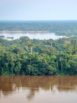
With approximatively 200 million hectares, the Congo Basin forests constitute the second largest block of humid tropical forests in the world. The Congo Basin forests are rich in biodiversity and they provide a critically important carbon sink. Earth observations provide reliable and up-to-date information on the state and dynamics of the forests that inform both international research initiatives in the region as well as national and regional decision making on conservation and climate change in Central Africa.
Objectives and priorities
OSFAC strengthens regional capacities to produce reliable information on forest cover change and biodiversity across Central Africa using satellite data and modern mapping techniques. OSFAC’s data, products and services directly support efforts of Central African states to equitably and effectively monitor and manage their environment and natural resources.
Forest monitoring by remote sensing: OSFAC and its partners – the University of Maryland, NASA, USAID/CARPE and FAO – conduct regular monitoring of the forests of the Congo Basin to produce information for climate change, REDD+, and landuse planning projects.
REDD+ (Reducing Emissions from Deforestation and forest Degradation): OSFAC provides technical support to national institutions and stakeholders for the implementation of REDD+ projects. The support mainly focuses on biomass and carbon quantification, carbon emissions and Monitoring Reporting and Verification (MRV/REDD+) activities.
Biodiversity and Conservation: in partnership with UNEP/WCMC, OSFAC uses spatial analysis to support national institutions in analyzing climate change impacts and synergies between REDD+, biodiversity and conservation programs.
Natural disasters and regional planning: OSFAC implements World Bank and UNDP projects on the analysis of natural risks in urban areas (erosion and flooding) and land development plans in the provinces of the Democratic Republic of Congo (DRC).
Accomplishments
To date OSFAC has:
• Developed and established a free distribution system for tens of thousands of satellite images and derived products for monitoring the forests and environment of the Congo Basin countries.
• Trained over 3,700 people from various institutions, organizations and universities on the use of new information technologies (GIS, Remote Sensing, GPS and Spatial Analysis) for sustainable management of forest analysis and natural resources.
• Actively contributed to the conservation of biodiversity and mitigation of climate change by regularly providing national and international institutions, civil society organizations and decision makers with reliable and relevant information on the state of forests (extent, gains, biomass, carbon and CO2 emissions) and wildlife habitat in the Congo Basin.
“In just a few years, and in collaboration with numerous partners, OSFAC has become a center of excellence, and is now training and helping others to increase their capacity in earth observations. 95 percent of the DRC’s GIS users were trained in one of OSFAC’s training labs.
We make our findings available for free, and we are committed to ensuring that the information produced through earth observations is used effectively for the sustainable management of the Congo Basin forests.” – Landing Mané, OSFAC Director


