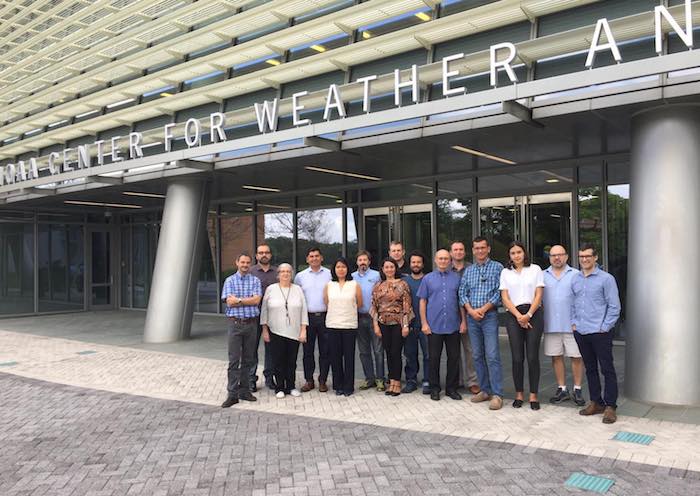
Experts met in October to discuss latest developments and initiatives on remote sensing for mapping wildfire hazard and land cover change in Latin America.
The meeting of the Latin American Regional Network for Remote Sensing and Forest Fires (RedLaTIF) of the Global Observation of Forest and Land Cover Dynamics (GOFC-GOLD) program took place on October 9-11, 2018 at the NOAA Center for Weather and Climate Prediction (NCWCP) in College Park, Maryland.
The discussions covered latest findings, tools, frameworks and projects. The meeting included presentations by “data producers”, institutes such as the US National Oceanic and Atmospheric Administration (NOAA) and the Brazilian Institute for Space Research, and by “data users”, including the National Institute for Agricultural Technology, Argentina (INTA) and the Geographic Institute Agustín Codazzi, Colombia (IGAC).
Participants discussed recent RedLaTIF achievements, including collaborations that resulted in the publication of findings in the peer-reviewed journal Revista da Teledetección.

The future of the network was also discussed, with participants agreeing on the need to augment regional representation, by identifying new members in under-represented countries such as Costa Rica, Trinidad, Ecuador, and Peru, home to a future hub of the NASA/USAID joint venture SERVIR. Participants also agreed on the need to continue collaborating, including on fundraising for the network.
More information and meeting presentations will be made available on the RedLaTIF website.
The Latin-American Network for Remote Sensing and Forest Fires (RedLaTIF) is a regional network established in 2002 under the Global Observation of Forest and Land Dynamics (GOFC/GOLD) – Fire Mapping and Monitoring Theme. RedLaTIF members are composed of remote sensing specialists with emphasis on the detection and mapping of active fires and burned areas. The network’s primary goals are to: (i) assess and validate global satellite fire products, (ii) promote use of remote sensing data, and (iii) bridge the gap between end users and space agencies.


